Learning about the 50 U.S. states is an important part of U.S. history. Each state is unique and should be appreciated for all it contributes to our great and diverse country. Building a practical understanding and a broader cultural knowledge of the states offers students a greater sense of geographical awareness, and cultural diversity, a window into the political and social insights of different regions, a better understanding of the economic contributions that each state makes, might spark an interest in domestic travel, and reinforces the teachings of civics and the importance of civic involvement. Learning about the 50 U.S. states deepens one’s understanding of the nation’s diversity, complexity, and unity, making it easier to engage in informed discussions and appreciate different perspectives across the country.
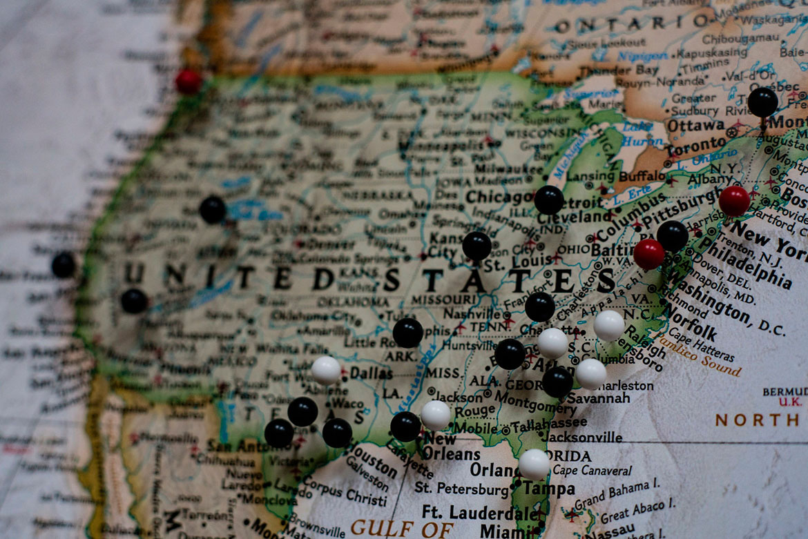
Swing states, not swing sets, are unique from all others because whereas many states lean historically Democratic or Republican candidates in elections, swing states do not. They swing back and forth between majority Democrat and Republican leadership. Swing states are critical to a political candidate’s success in an election.
Arizona (AZ)
Arizona is located in the Southwestern United States. It is home to 6.7 million people and has a land area of 113,990 square miles. This swing state was accepted into the union on February 14, 1912 as the 48th state. Arizona's capital and largest city is Phoenix.
Florida (FL)
Florida is the most Southeastern state of the United States. It was admitted to the union in March of 1845 as the 27th state. Florida is the 3rd most populous state with 19.5 million people. It has an area of 65,755 square miles. Florida's capital is Tallahassee, its largest city is Jacksonville and the largest metropolitan area is Miami.
Georgia (GA)
Georgia is located in the Southeastern United States just north of Florida. It was one of the 13 original colonies and the 4th state to be admitted to the union in January of 1788. Georgia is the 8th most populous state with 10 million residents. Its total area is 59,425 square miles. The capital and most populous city is Atlanta.
Michigan (MI)
Michigan is located in the Great Lake region of the Midwest and is divided into two peninsulas, The Lower Peninsula and The Upper Peninsula. Michigan was the 26th state to enter the union in January of 1837. Michigan has a total land area of 57,022 square miles and a total water area of 39,769 square miles, making it the state with the most area made of water. Michigan's capital is Lansing, the largest city is Detroit and the total state population is 9.9 million people.
Nevada (NV)
The state of Nevada extends across parts of the Western and Southwestern regions of the United States. It has a population of 2.7 million residents and an area of 110,567 sq. miles. The state capital is Carson City while the largest city is Las Vegas at the southern tip of the state. Nevada was the 36th state, admitted in October 31st, 1864.
North Carolina (NC)
North Carolina is located in the southeastern United States and was the 12th state admitted to the union on November 21st, 1789. The state population is 9.8 million people and the area is 53,821 sq. miles. The state capital is Raleigh and the largest city is Charlotte.
Learn More About North Carolina
Ohio (OH)
The state of Ohio is located in the Midwestern and Great Lake region of the United States. It has an area of 44,828 sq. miles and a population of 11.5 million people, making it the 7th most populous state. The capital and largest city is Columbus. Ohio was the 17th state accepted to the union on March 1st, 1803.
Pennsylvania (PA)
Pennsylvania was the 2nd state to ratify the U.S. constitution and gained statehood on December 12th, 1787. Pennsylvania is located in the Mid-Atlantic region of the U.S. and has an area of 46,058 sq. miles. The state population is 12.7 million people, making it the 6th most populous state in the country.
Wisconsin (WI)
Wisconsin is located in the north-central region of the United States and has an area of 65,503 sq. miles. The population is 5.7 million people and the largest city is Milwaukee. The state capital is Madison. Wisconsin became the 30th U.S. state on May 29th, 1848.
Each of our 50 states has something unique to offer and understanding each state’s contributions puts us in a better position to understand the positions and views of the people that reside in each state and community in it. In celebrating the differences between our American communities, we can also acknowledge the many things that we have in common. For example, every community values the opportunity to offer its children safe places to play. Playground equipment in parks and schools across the country brings together children of all ages and abilities. These public spaces are not only fun places for children to enjoy active outdoor play equipment. They are also places for communities to come together on park benches and picnic tables. These are neutral spaces to meet and build connections and friendships. As such important community assets, it’s important the parks and playgrounds of the U.S. are open and well-maintained, supported, and advocated for by constituents of both political persuasions.
Alabama (AL)
Located in the Southeastern United States, Alabama is home to 4.8 million people. The state's area totals 52,420 square miles. Alabama's capital city is Montgomery, while the largest city is Birmingham. Alabama was the 22nd state, accepted into the union in December of 1819.
Alaska (AK)
Alaska is located the in far Northwest corner of North America, bordering Canada. It is one of two non-contiguous U.S. states. Alaska is the largest state by area, however it is the least densely populated state with only 736,732 people in an area of 663,268 square miles. It was accepted into the union in 1959 as the 49th state.
Arkansas (AR)
Arkansas is one of the Southern U.S. states, accepted into the union in June of 1836 as the 25th state. Arkansas has a land area of 53,180 square miles and a population of 2.9 million. Located near the geographical center of the state, Little Rock is both the state's capital and largest city.
California (CA)
California is located on the west coast of the United States. It is the most populous state in the country with 38.3 million people. It is also the 3rd largest state by area, after Alaska and Texas, with a total of 163,696 square miles. It was the 31st state, admitted into the union in September 1850. The state capital is Sacramento and Los Angeles is both the state's most populated city as well as the country's second most populated city.
Colorado (CO)
Colorado is a mountain state in the western United States. The state has a land area of 104,094 square miles and a population of about 5.3 million people. The state was admitted into the union August of 1876 as the 38th state. Denver is the state's capital and largest city. Denver is nicknamed the Mile High City because its official elevation is exactly one mile (5,280 ft.) above sea level.
Connecticut (CT)
Connecticut is one of six states that make up the Northeastern region of the United States known as New England. It's the third smallest state with an area of just 5,543 square miles. The total population is 3.5 million people. The capital is Hartford, while the largest city in the state is Bridgeport. Connecticut was one of the 13 original colonies, joining the union on January 9, 1788.
Delaware (DE)
Delaware is a Mid-Atlantic state, located on the east coast of the United States. It is the second smallest state with an area of 1,982 square miles and home to about 935,614 people. It was the first state admitted it the union on December 7, 1787. Delaware's capital city is Dover, while the largest city is Wilmington.
Hawaii (HI)
Hawaii, or Hawai'i, is an archipelago, or cluster of eight main islands and many smaller islands extending 1,500 miles in the central Pacific Ocean. It is one of two states that are not in the contiguous United States. Hawaii was the last state to be admitted to the union in August of 1959. Hawaii's total area is 10,931 square miles, 41.2% of which is water. The state's population is 1.4 million with the largest city and capital being Honolulu.
Idaho (ID)
Idaho is a mountainous state located in the northwestern region of the United States. It became the 43rd state in July of 1890. Idaho has an area of 83,632 square miles and approximately 1.6 million people live in the state. Boise is both the state's capital and largest city.
Illinois (IL)
Illinois is located in the Midwestern United States. It is the 5th most populated state with 12.9 million people. The state's total area extends 57,914 square miles. The state's capital is Springfield and the largest city is Chicago It is home to 2.7 million people and is the 3rd most populous city in the United States. Illinois became the 21st state in December of 1818.
Indiana (IN)
Indiana is located in the Midwestern region of the United States, just east of Illinois. It was the 19th state to be admitted to the union in December of 1816. Indiana has a population of 6.5 million and a total area of 36,418 square miles. Its largest city and capital is Indianapolis.
Iowa (IA)
Iowa is located in the U.S.'s Midwest. It is bordered by the Mississippi River on the east and the Missouri and Big Sioux River on the West. Iowa has a population of 3.1 million and a total area of 56,272 square miles. It was named the 29th state to enter the union in December of 1846. Iowa's capital and largest city is Des Moines.
Kansas (KS)
Kansas is located in the country's Midwest and is known as one of the Great Plains states. It was the 34th state to enter the union in January of 1861. The state holds a population of 2.9 million people and a total area of 82,277 square miles, with just .5% being water. The state's capital is Topeka, the largest city is Wichita and the largest metropolitan area is Kansas City. Jayhawk Plastics, a manufacturer of commercial outdoor benches is located in Olathe, Kansas.
Kentucky (KY)
Kentucky, officially known as the Commonwealth of Kentucky, is located in the south-central region of the country. Kentucky became the 15th state to join the union in June 1792. The state's population is 4.4 million people, with the largest city being Louisville. Kentucky's total area is 40,409 square feet and the capital city is Frankfort.
Louisiana (LA)
The state of Louisiana is located in the southern region of the United States. It was the 18th state to be admitted into the union in April of 1812. Louisiana has a population of just over 4.6 million people among its 51,843 square miles. The capital city is Baton Rouge and the largest city and major U.S. Port is the city of New Orleans.
Maine (ME)
Maine is the most Northeastern state in New England and the country. It was admitted as the 23rd state to the union in March of 1820. The population sits at 1.3 million and has an area that expands 35,385 square miles. Maine's largest city is Portland, however, Augusta has been the capital since 1827.
Maryland (MD)
Maryland is located in the Mid-Atlantic region of the United States. It was one of the 13 original colonies and was the 7th state to ratify the United States Constitution on April 28th, 1788. Maryland has a total area of just 12,407 square miles. The state's population is 5.9 million people making it the 5th most densely populated state in the country.
Massachusetts (MA)
Massachusetts, officially, the Commonwealth of Massachusetts is located in the northeastern region of the U.S. Known as New England. It was one of the original 13 colonies and was admitted into the union on February 6th, 1788 as the 6th state. The capital and largest city is Boston and the total state population is equal to 6.7 million people. Massachusetts's area totals 10,555 square miles, making it the 7th smallest state and the 3rd most densely populated state.
Learn More About Massachusetts
Minnesota (MN)
Minnesota became the 32nd state in the USA and did so on May 11th, 1858. It is located in the northern Midwest region of the country with a population of 5.4 million people. The state's area equals 86,943 square miles. The state capital is Saint Paul and the largest city is Minneapolis.
Mississippi (MS)
Mississippi is located in the southern United States, east of Louisiana and Arkansas and west of Alabama. Mississippi became the 20th U.S. state in December of 1817. The state population is 2.9 million and the total area is 48,434 sq. miles. The state capital and largest city is Jackson.
Missouri (MO)
Missouri is located in the great Midwestern region of the United States. It was the 24th state admitted to the U.S. on August 10, 1821. The state capital is Jefferson City, the largest city is Kansas City and the largest metropolitan area is Saint Louis. The total state population is 6 million and total area expands 69,709 square miles.
Montana (MT)
Montana became the 41st state on November 8th, 1889. It is located in the Northwestern region of the United States and has a population of a little over 1 million. Montana has an area of 147,046 square miles, making it the 4th largest state in the country. The state capital is Helena and the largest capital is Billings.
Nebraska (NE)
Nebraska was the 37th state admitted to the union on March 1st, 1867. It is among the Great Plains state in the Midwestern United States. The population is 1.8 million people and the total area is 77,358 sq. miles. The state capital is Lincoln and the largest city is Omaha.
New Hampshire (NH)
New Hampshire, one of the 13 original colonies, was the 9th state to join the union on June 21st, 1788. It is located in the New England region of the U.S. The state has a population of 1.3 million people and an area of 9,351 sq. miles, making it the 5th smallest U.S. state. The state capital is Concord and the largest city is Manchester.
Learn More About New Hampshire
New Jersey (NJ)
New Jersey is located in the Mid-Atlantic region of the country. It was the 3rd state in the U.S., earning its statehood on December 18th, 1787. The state has a population of 8.9 million people and an area of 8,722 sq. miles, making it the most densely populated state in the U.S. The state capital is Trenton and the largest city is Newark.
New Mexico (NM)
New Mexico is located in the Southwestern region of the country and earned statehood on January 6, 1912 as the 47th state. It has an area of 121,593 sq. miles and the 5th largest state in the country. The state population is 2 million people, the state capital is Santa Fe and the largest city is Albuquerque.
New York (NY)
New York is a Mid-Atlantic state, was one of the original 13 colonies and earned statehood on July 26, 1788 as the 11th state. N.Y. has a population of 19.6 million people and is the third most populated state. Albany is the state capital and New York City is the largest city. With about 8.4 million people, it is also the most populous city in the U.S.A. The state's area totals 54,475 sq. miles
North Dakota (ND)
North Dakota is located in the Northern Midwest of the United States. It became the 39th state on November 2nd, 1889, the same day as South Dakota. The state's total area is 70,704 sq. miles and has a population of 723,393 people, making it the 3rd least populous state in the country. The state capital is Bismarck and the largest city is Fargo.
Oklahoma (OK)
Oklahoma is located in South Central United States. Oklahoma earned its statehood on November 16th, 1907 as the 46th state. It has a population of 3.8 million people and an area of 69,903 sq. miles. The state capital and largest city is Oklahoma City.
Oregon (OR)
Oregon is located in the Northwestern United States and has a total area of 98,386 sq. miles. It became the 33rd state in the U.S. on February 14, 1859. Oregon has a population of 3.9 million people. The state capital is Salem and the largest city is Portland.
Rhode Island (RI)
Rhode Island is apart of Northeastern region of New England. It has a land area of just 1,045 sq. miles, making it the smallest state in the U.S. The state population is 1.05 million and the state's capital and largest city is Providence. Rhode Island was the 13th state admitted to the union on May 29th, 1790.
South Carolina (SC)
South Carolina is located in the Southeastern U.S., bordered by North Carolina to the north and Georgia to the south and west. It became the 8th U.S. state on May 23rd, 1788. South Carolina has a population of 4.7 million people and an area of 32,007 sq. miles. The state capital and largest city is Columbia.
Learn More About South Carolina
South Dakota (SD)
South Dakota is located in the Northern Midwest, just south of North Dakota. It was the 40th state admitted to the union on November 2, 1889, the same day as North Dakota. It has an area of 77,121 sq. miles and a population of 844,877, making it the 5th least populous state in the country. The state capital is Pierre and the largest city is Sioux Falls.
Tennessee (TN)
Tennessee is a southeastern state with a population of 6.49 million people. It was the 16th state, admitted to the union June 1st, 1796. Tennessee has an area of 42,146 sq. miles, with Memphis being the largest city and Nashville being the state capital.
Texas (TX)
Texas is located in south central United States and is the 2nd largest state in the country and largest state in the contiguous U.S. with an area of 268,601 sq. miles. It is also the 2nd most populous state with 26.9 million residents. Houston is Texas' largest city and the countries 4th largest city. Austin is the state capital. Texas was the 28th state admitted on December 29th, 1845.
Utah (UT)
Utah was the 45th state admitted to the union on January 4, 1896. The state is in the western United States with an area of 84,904 sq. miles. The state has a population of 2.9 million people and its state capital and largest city is Salt Lake City.
Vermont (VT)
Vermont is located in the Northeastern U.S. region of New England. It became the U.S.'s 14th state on March 4th, 1791. Vermont has an area of 9,615 sq. miles and a population of 626,630, making it 2nd least populous state. The capital is Montpelier and the largest city is Burlington.
Virginia (VA)
On June 25th, 1788, Virginia became the 10th state of the U.S. Officially The Commonwealth of Virginia; it is located in the southern part of the Mid-Atlantic. Virginia's population is 8.2 million people and has an area of 42,769 sq. miles. The largest city is Virginia Beach and the state capital is Richmond.
Washington (WA)
Washington State is located in Northwestern United States. It was the 42nd state to be admitted to the U.S. on November 11th, 1889. The state has a population of 6.9 million people and an area of 71,303 sq. miles. The state capital is Olympia and the largest city is Seattle.
West Virginia (WV)
West Virginia is located in the southern United States, in a region known as Appalachian. West Virginia was the 35th state and earned statehood on June 30th, 1863. The state capital and largest city is Charleston. West Virginia has a population of 1.8 million people and an area of 24,231 sq. miles.
Learn More About West Virginia
Wyoming (WY)
Wyoming is located in the mountain region of the western United States. It was the 44th state accepted into the union in July of 1890. Wyoming has an area of 97,814 square miles and has the lowest population out of all 50 states with only about 584,153 residents. The capital and largest city is Cheyenne.
Learning about the U.S. can be easy and fun, especially if you like geography. Find a comfortable spot under an outdoor shade structure and check out these resources. You never know, maybe there’s another kid in another state on the opposite side of the country, sitting under playground shade structures and learning about the state that you live in.
Update 09/19/2024 by Author Kim Hart